What is Freemap?
Freemap is a project to create free and annotatable maps of the UK countryside, using OpenStreetMap data to create the maps. Freemap maps aim to show not only the official rights of way, but all paths with public access, many of which are missing on other maps.
Map key
The following diagram (based on a previous version, but the current version of Freemap is to all intents and purposes identical) shows the colour scheme for different types of path (permissive footpaths, not shown here, are light blue):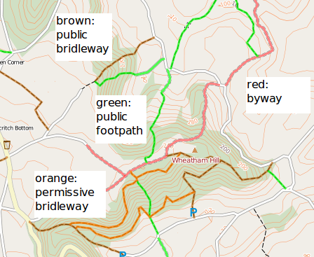
The maps consist of two layers. The top layer (coloured) shows the routes with public access, as shown above. The lower layer (black and white) gives an indication of the path's physical condition, for example whether it's a dirt path, a track, or a farm access road. The second diagram shows examples of the lower layer, and also shows a permissive footpath:
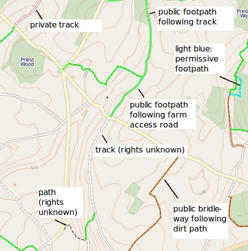
Note how some paths and tracks have no coloured overlay. These are paths and tracks for which walkers' rights are unknown, i.e. it is not known whether they are walkable or private. Also note the public footpath in the top centre of the map, and how its southern end follows a farm access road and its northern end follows a track.
Source code
Freemap source code is available via github; see here. The SVN repository is no longer being maintained.
Nick Whitelegg (OSM username: nickw) Email